The St. Clair River defines Sarnia’s western edge, but its legacy lies beneath the surface in the form of saturated, glaciolacustrine clay deposits that extend across the city. For any project requiring a cut deeper than 4.5 metres—from the new residential developments taking shape north of Highway 402 to the industrial expansions in Chemical Valley—the geotechnical design of deep excavations becomes a critical first step, not an afterthought. Unlike the till-dominated terrain found further inland, the Sarnia subsurface demands a nuanced understanding of undrained shear strength profiles and pore pressure dissipation. The excavation design must account for the rapid loss of suction in these sensitive clays when exposed to construction dewatering, a condition frequently encountered when integrating in-situ permeability testing data into the hydraulic model. Without this integration, temporary works can underestimate lateral earth pressures, leading to costly delays. The local practice, guided by experienced engineers familiar with the regional stratigraphy mapped by the Ontario Geological Survey, relies on combining empirical data from CPT testing with advanced finite element analysis to predict wall deflections before the first bucket of soil is removed.
In Sarnia's Champlain-like clays, the factor of safety against basal heave often dictates the wall embedment depth more than the structural bending moments do.
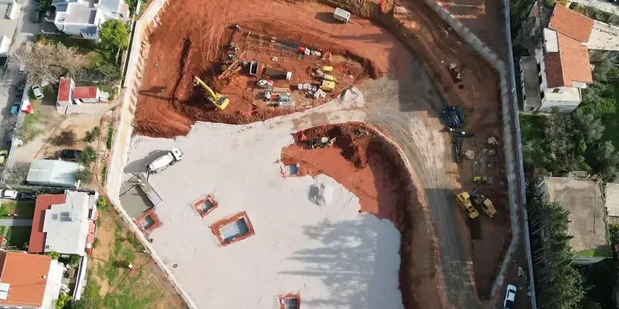
Process and scope
A persistent error made by contractors unfamiliar with Sarnia’s geology is treating the upper crust—a stiff, desiccated veneer about 1.5 to 2 metres thick—as representative of the entire soil column. This over-consolidated layer masks the soft, normally consolidated clay beneath, which can lose up to 60% of its apparent strength when disturbed. A solid geotechnical design of deep excavations here must distinguish between short-term stability, which benefits from the crust, and long-term serviceability, which is governed by creep and consolidation of the deeper Lake Warren clays. The design process typically involves staged excavation analysis, where each lift is calibrated against inclinometer targets and piezometric readings. Where tieback anchors prove impractical due to underground utilities or right-of-way restrictions, the design often shifts to internally braced systems or cantilever walls reinforced with
stone columns to improve passive resistance at the toe. Furthermore, the proximity to the river means that basal heave calculations must incorporate upward seepage gradients, a scenario that routinely validates the inclusion of a comprehensive
grain size analysis to confirm the filter compatibility of any proposed drainage blanket.
Local ground factors
Sarnia’s urban grid expanded rapidly during the mid-20th century petrochemical boom, leaving a patchwork of historical fills, undocumented backfilled ravines, and abandoned service corridors that complicate modern deep excavation design. The most notorious geotechnical incidents in the region involve sudden inflow of water through unsealed exploration boreholes that penetrate the confined aquifer beneath the clay till. When a deep excavation design fails to mandate a thorough desk study of historical well logs and oil drilling records—many held by the Ministry of Natural Resources—the risk of encountering high artesian pressures at the base of the cut increases exponentially. This can instantly fluidize the bottom of the excavation, a phenomenon known as piping, which has led to catastrophic collapses during basement construction in the downtown core. The design must therefore prescribe rigorous pre-excavation probing and, in critical zones near the river, specify a controlled dewatering scheme that maintains a hydraulic gradient safely below the critical value derived from Terzaghi’s classic heave equations.
Quick answers
What is the typical cost range for a geotechnical excavation design for a site in Sarnia?
For a standard commercial lot requiring a single-level basement, the design package—including soil-structure interaction analysis, shoring drawings, and a dewatering impact assessment—generally falls between CA$2,920 and CA$12,850. The range depends on the complexity of the adjacent infrastructure, the depth of the cut, and whether a peer review is required by the municipality under the Ontario Building Code.
How does the St. Clair River affect deep excavation stability?
The river maintains a high regional groundwater table and contributes to an active seepage regime through the interface between the silty clay layer and the underlying till. During design, we must calculate the exit gradient at the excavation base to prevent piping. The seasonal fluctuation of the river level, typically within a one-metre range, is also factored into the worst-case hydrostatic loading scenario for the wall.
Which retaining wall system works best in Sarnia's soft clay?
Soldier pile and lagging walls with tieback anchors are common for sites with sufficient setback, but internally braced systems or secant pile walls often perform better in the deep, soft clay zones south of the 402. The final selection depends on the sensitivity of the clay—if the liquidity index is above 1.2, ground improvement methods like jet grouting at the toe may be necessary to achieve the required passive resistance.
What are the key deliverables in a deep excavation design report?
The report includes a geotechnical interpretation of the stratigraphy, a lateral earth pressure envelope, structural capacity checks for the shoring elements, a dewatering plan with predicted flow rates, and a construction sequence specifying maximum unsupported cut heights. It also contains a monitoring section that defines trigger levels for wall deflection and groundwater drawdown, aligned with the thresholds set by the Ontario Ministry of Labour.