← Home · Underground Excavations

Geotechnical Excavation Monitoring in Sarnia: Precision Below the Water Table

Together, we solve the challenges of tomorrow.

LEARN MORE →

Open cuts in Sarnia behave differently than up on the Shield. Here, the water table sits barely two meters below grade across much of the St. Clair Plain, and the near-surface clays lose shear strength fast once the dewatering balance shifts. We see it on refinery expansion jobs and riverfront utility trenches alike: the excavation looks dry for two weeks, then a sustained rain raises the pore pressure and the bottom starts softening under the excavator tracks. That is why our monitoring approach in Sarnia starts with vibrating wire piezometers installed well before the dig reaches final grade. Real-time pressure data tells us when to adjust the dewatering wellfield—before the heave shows up in the trench floor. For deeper cuts in the Aylmer till, we combine the piezometer array with in-situ permeability testing to calibrate the groundwater model with site-specific numbers rather than textbook assumptions.

In Sarnia, the excavation fails from the bottom up—clay softening and basal heave—long before the shoring wall shows a millimeter of deflection.

Process and scope

Sarnia's industrial backbone was built on the same soft lacustrine clays that challenge every excavation south of the 402. The Chemical Valley plants from the 1940s onward drove a wave of deep foundation work, but many of those records are paper files in a basement. Our team has pulled enough old borehole logs from the Lambton County archives to know that the clay thickness changes by six meters across a single city block. That variability demands a monitoring plan that does not assume uniform stratigraphy. Inclinometer casings grouted into the till let us track lateral deformation with a resolution of 0.01 mm/m, and we verify the soil parameters in our ISO 17025-accredited lab using grain-size analysis to confirm whether the fines content matches the assumptions in the shoring design. Settlement points on adjacent structures, crack gauges on the curb lines, and automated total station prisms on the waler beams round out a typical monitoring array for a downtown Sarnia excavation.
Geotechnical Excavation Monitoring in Sarnia: Precision Below the Water Table
Technical reference image — Sarnia

Local ground factors

North-end excavations in the thicker clay deposits behave differently than the sandier profiles near the St. Clair River. Downtown, we monitor for basal heave because the clay unit extends past 20 meters and the weight of the retained soil can squeeze the floor upward. Along the waterfront, the risk shifts to piping and bottom instability as soon as the cut penetrates the sand lens that sits under the upper clay crust. A dewatering system that works perfectly in the Mitton Village area can pull fine sand into the sump at a Front Street site, undermining the adjacent roadway. Without continuous piezometer feedback, the first sign of trouble is usually a sinkhole opening in the street outside the hoarding. We set threshold alarms at 70% of the design groundwater drawdown so the superintendent has a margin to react before the night shift finds a problem.

Need a geotechnical assessment?

Reply within 24h.

Email: [email protected]

Explanatory video

Technical parameters

ParameterTypical value
Inclinometer resolution0.01 mm/m
Piezometer range0–350 kPa
Automated total station accuracy1 arc-second
Data logging interval15 min (configurable)
Vibrating wire readout unit±0.05% F.S.
Settlement point precision±0.5 mm
Crack gauge range±25 mm

Associated technical services

01

Inclinometer & Shape Array Monitoring

Grouted-in-place or traversing probe inclinometers installed behind the shoring wall to capture lateral deformation profiles. Data is processed against the baseline reading taken before the first bucket leaves the site.

02

Vibrating Wire Piezometer Networks

Multi-level piezometer strings in dedicated boreholes to track pore pressure at the excavation base, behind the wall, and outside the zone of influence. Readings are logged automatically and pushed to a cloud dashboard.

03

Surface & Structural Settlement Arrays

Precision level surveys on settlement points installed on adjacent building foundations, utility chambers, and curb lines. Crack gauges on pre-existing masonry cracks provide continuous displacement data.

Applicable standards

NBCC 2020, CSA A23.3-19, ASTM D7299 (Inclinometer), ASTM D7764 (Vibrating Wire Piezometer)

Quick answers

What is the cost range for geotechnical excavation monitoring on a typical Sarnia commercial project?

For a standard three-month monitoring program covering one shored excavation with inclinometers, piezometers, and settlement points, the cost typically falls between CA$1,180 and CA$3,310, depending on the number of instruments, reading frequency, and reporting requirements.

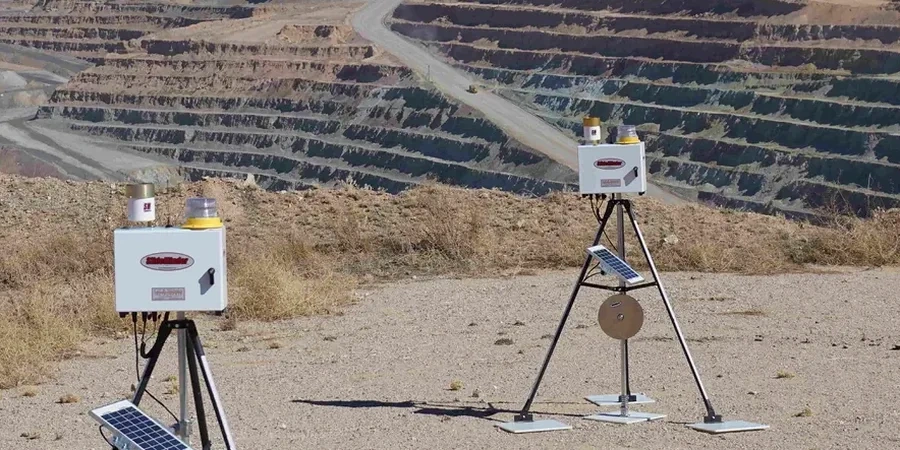
Which NBCC provisions apply to excavation monitoring in Sarnia?

NBCC 2020 Part 4 references the need for observation and review during construction, and Section 4.2.4 addresses excavation and dewatering near existing buildings. The geotechnical engineer of record defines the monitoring thresholds based on the site-specific design, with the monitoring plan reviewed as part of the building permit submission for deep excavations.

How often are inclinometer and piezometer readings taken during active excavation?

Automated piezometers can log every 15 minutes. Manual inclinometer traverses are typically performed daily when the excavation is within 1.5 meters of final grade, and weekly during the earlier stages. Frequency adjusts based on observed deformation rates against the alarm thresholds set in the monitoring plan.

Location and service area

We serve projects in Sarnia and surrounding areas.

View larger map